Remote observations show patterns, while practical decisions depend on explaining what those patterns could mean. Interpretation therefore requires more than locating a high or low value on a map. A useful analysis considers the timing of the observation, the physical processes that influence the measurement, and the information available from complementary sources. This perspective separates an observed signal from a proposed explanation and from an action recommended to a user. Keeping those stages distinct makes it easier to investigate alternative causes, communicate ambiguity, and choose a proportionate next step.
This working guide considers building a spacecraft power and energy budget over inland reservoir waters. The immediate decision is to select water-sampling locations. Useful reference evidence includes water samples, acquisition timing and reservoir-level context. The case is an illustrative planning context, with assumptions to check against the actual sensor, landscape and project requirements.
Distinguish power from stored energy
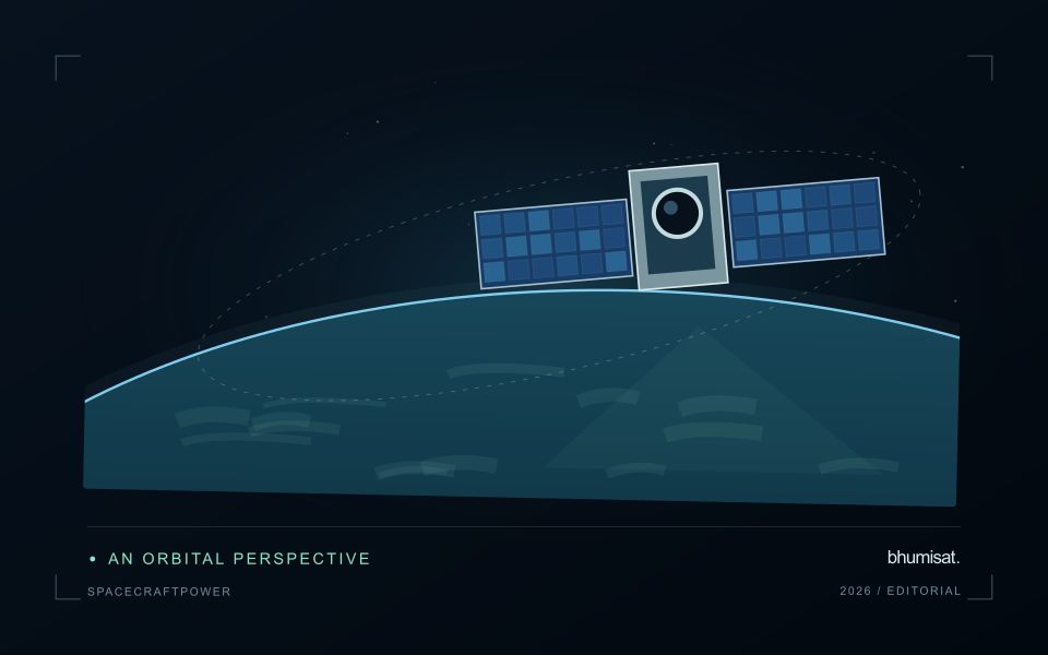
A spacecraft electrical power system must generate energy, store it when necessary and distribute it reliably to the loads. Power describes the rate of energy use, while energy describes consumption over an interval. A transmitter may have a high instantaneous demand even if it operates briefly. Conversely, a modest continuous load can dominate the daily energy budget. Both views are needed to size the system.
List operating modes and their duration: standby, imaging, processing, communication, safe mode and any relevant transitions. Include heaters, power conversion losses and supporting electronics rather than counting only the camera and radio. Identify loads that overlap in time and those that can be scheduled separately. Peak current and startup behavior can challenge distribution hardware even when the average energy balance appears comfortable.
Check realistic orbit and lifetime conditions
Solar generation depends on illumination, array orientation, temperature and the condition of the cells and associated hardware. Eclipse intervals require stored energy, and imaging or communication pointing may reduce favorable Sun exposure. Evaluate the time sequence across representative orbits rather than comparing one average generation number with one average load. Consider the expected decline in performance over the mission and apply clearly justified design margins.
Battery sizing must consider usable capacity under the planned temperature, discharge rate and cycling conditions. Nominal capacity alone does not describe what is safely available in service. Charging limits, allowed depth of discharge, ageing and monitoring requirements influence the operating envelope. Thermal design and power planning therefore need to evolve together. A heater can protect a battery while consuming the energy that the battery is expected to deliver.
The distribution system should detect and isolate relevant faults while preserving essential functions. Define which loads are shed when energy becomes scarce and what conditions allow them to return. Safe mode needs its own verified energy balance and a credible path toward recovery. Telemetry should support comparison between predicted and measured generation, consumption and battery behavior. Test the budget with realistic duty cycles, instrument startup sequences and communication sessions, then update the model using measured component performance. A defensible power plan explains the worst cases and the assumptions behind its reserve, allowing observation schedules to be adjusted before they threaten spacecraft survival.
The setting: Inland reservoir waters
A reservoir image records water alongside shorelines, shallow areas, vegetation and surrounding land. The mixture visible at its margins changes as water level varies. A monitoring programme should distinguish mapping water extent from estimating a particular water-quality variable. These tasks may share observations, but they require different reference data and different rules for excluding surfaces that do not represent the open water of interest.
Optical interpretation depends on atmospheric conditions, surface reflections and the substances influencing the water signal. A bright patch could have several explanations, so an image feature should be treated as a question for investigation unless its relationship with a defined variable has been evaluated. Review clouds, shadows, sun glint and adjacency to bright land. Sampling footprints near a shoreline may need separate treatment because their measurements can include both land and water.
Field validation should connect each water sample to its location, collection time and the conditions relevant to the acquisition. A sample taken after a major change in inflow may not represent what the satellite observed earlier. Include different parts of the reservoir and the range of conditions expected in use. The final product should communicate whether it shows a spectral pattern, a calibrated estimate or a confirmed sampling result, rather than presenting those forms of evidence as identical.
Represent gaps without inventing observations
A monitoring sequence often contains periods without a usable observation. The reason may be cloud, shadow, missing coverage, a failed transfer, or a quality condition that excludes the data. Begin by representing these states explicitly. A missing observation is different from a low measurement, an unchanged surface, or a confirmed absence of the feature being studied. The distinction should survive both the analysis and the presentation of the result.
Define when a temporal gap is acceptable for the intended decision. A workflow may continue using the latest qualified observation, request another source, or suspend an alert until sufficient evidence is available. Whichever response is selected, show the age of the supporting observation. If interpolation is used for a suitable analytical purpose, preserve the distinction between an estimated value and a directly observed measurement, together with the assumptions needed to interpret it.
Review how gaps affect the coverage of the final evaluation. Locations with frequent missing data may differ systematically from those with regular observations. A performance estimate based only on clear, complete records can therefore describe a narrower population than the service is expected to support. Report usable coverage alongside analytical results and use recurring gaps to guide acquisition planning, reference collection, and the selection of complementary observation methods.
Maintain the geographic units of analysis
Many observation services summarise measurements within a field, management block, catchment, forest unit, or other mapped boundary. The meaning of that summary depends on whether the boundary accurately represents the unit being discussed. Start with a clear source for the geometry and record its date, coordinate reference, and intended use. A boundary drawn for visual orientation may require additional checking before it becomes a measurement unit.
Inspect overlaps, gaps, narrow fragments, and features that may have changed since mapping. A geometrically valid polygon can still describe an outdated operational unit. Ask the responsible team how divisions, mergers, new infrastructure, and management changes are recorded. Where pixels or reference measurements cross a boundary, define how they are assigned or excluded so that results remain comparable between analysts and processing runs.
Version the boundaries alongside the observations. If a unit changes, preserve a relationship between the previous and revised geometry rather than replacing the history without explanation. Comparisons through time should identify whether they use a constant spatial unit or the operational units valid at each date. This makes it easier to distinguish a change in the measured surface from a change introduced by the geography used to summarise it.
Bring the evidence back to the decision
A strong interpretation states what was observed, which explanations remain plausible, and what additional evidence would help distinguish them. Avoid presenting a convenient label as a confirmed cause when the measurements support only a broader pattern. Connect the proposed next step to the significance of the decision and the confidence available. This creates an interpretation that a field team, analyst, or project partner can examine, challenge, and improve as further observations become available.
Sources & further reading
Explore the bhumisat spacecraft concept and our vision towards 2030, or return to the journal.