Remote observations show patterns, while practical decisions depend on explaining what those patterns could mean. Interpretation therefore requires more than locating a high or low value on a map. A useful analysis considers the timing of the observation, the physical processes that influence the measurement, and the information available from complementary sources. This perspective separates an observed signal from a proposed explanation and from an action recommended to a user. Keeping those stages distinct makes it easier to investigate alternative causes, communicate ambiguity, and choose a proportionate next step.
This working guide considers testing whether a remote sensing model transfers in agricultural payload studies. The immediate decision is to define testable agricultural observation requirements. Useful reference evidence includes application trials and traceable payload measurement specifications. The case is an illustrative planning context, with assumptions to check against the actual sensor, landscape and project requirements.
The setting: Agricultural payload studies
An agricultural satellite payload study should begin with the information needed by its intended users. A proposed observation might support crop-stage comparison, vegetation mapping or a field-inspection priority, and each use can imply different requirements. A list of spectral channels is only one part of that definition. The study should establish which variable or pattern is being investigated, the landscape scale at which it matters and the evidence that would show the resulting information is useful.
Candidate methods can be explored using suitable existing imagery and field measurements before the independent payload design is finalised. These trials help identify which observations add useful information and which conditions create ambiguity. Record the spatial support, acquisition timing and calibration assumptions behind the results. Performance demonstrated in one application setting should remain evidence for that setting until the wider range of crops, management systems and conditions has been evaluated.
Payload requirements should connect those findings to measurable instrument and system properties. Spectral response, image geometry, radiometric consistency and delivery timing belong in the same discussion as platform constraints. A concept illustration does not establish that these requirements have already been met. The practical output of this stage is a traceable set of application needs, test methods and design decisions, allowing researchers and engineers to discuss what should be demonstrated before stronger mission claims are made.
Identify what changes between domains
A model trained on one region or season learns relationships present in its development data. Applying it elsewhere assumes those relationships remain useful. New crop varieties, forest types, soil colours, management practices, illumination, or sensor characteristics can violate that assumption. Define the intended transfer explicitly: a new district, another year, another sensor, or a different class distribution. Each change creates a different test. A model that transfers across nearby fields has not thereby demonstrated reliable performance across climates or observation systems.
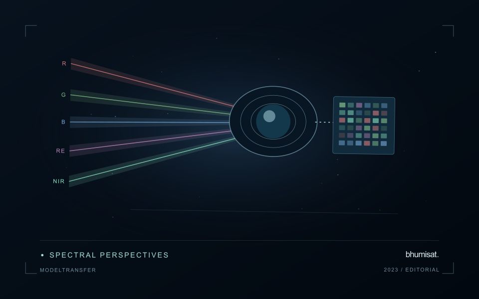
Keep the measurement pipeline consistent before attributing differences to the model. Reflectance scaling, band order, cloud masking, spatial resolution, composite windows, and missing value handling can all change predictions. Sensors with similarly named bands may have different spectral responses. Harmonization can reduce some differences but does not establish equivalence for every target. Examine predictor distributions, missing data rates, and examples from the new setting. Flag inputs outside the conditions represented during training so that extrapolation remains visible.
Test the destination, then adapt carefully
Design evaluation splits around the intended deployment. Hold out geographic regions to test spatial transfer and later years to test temporal transfer, keeping neighboring samples or repeated observations of the same site together when needed. Report performance for meaningful destination groups rather than only a pooled score. Class prevalence affects some metrics, so interpret changes alongside the underlying confusion matrix or residual distributions. A random pixel split can look excellent while providing little evidence about performance in an unseen region.
If local labels are available, reserve a destination assessment set before fine tuning or recalibration. Use the remaining observations to compare straightforward baselines with more complex adaptation methods. Check whether improvement comes from genuine transfer or simply from adding representative local data. Retain an option to withhold predictions when input quality or novelty makes them unreliable. Document the training domain, destination evidence, preprocessing versions, and conditions where use is unsupported. Continue monitoring once new observations arrive, since seasonal and environmental shifts can emerge after an initial evaluation. Transferability is a measured property of a particular model, workflow, target, and destination; it should not be inferred from architecture name or strong performance on the original test set.
Plan the evidence needed for calibration
Calibration connects an instrument's recorded response with a measurement that can be interpreted consistently. Begin by identifying which aspects of the response matter to the application: variation across channels, changes with operating conditions, geometric alignment, or differences between repeated observations. A calibration plan should state the quantities being assessed and the evidence needed to determine whether the response is sufficiently characterised for the intended use.
Design tests around controlled and documented conditions. Record the reference source, instrument configuration, exposure settings, temperature conditions, and processing applied to the measurements. Repeat suitable observations to investigate variability and distinguish a consistent response from a single favourable result. The reference itself has limitations, so preserve its characterisation and avoid assuming that every difference originates in the instrument under evaluation.
Connect calibration activities with the expected operating environment and processing chain. A correction that works under one test condition may require further evidence before being applied elsewhere. Define how calibration parameters are versioned, checked, and associated with the observations they support. Include a plan for recognising drift or other changes that could affect interpretation. The outcome should be an instrument response supported by traceable evidence, together with acceptance criteria that remain relevant to the application.
Organise imagery and results for reliable retrieval
A useful storage design helps people and software find the right observation without relying on informal knowledge of folder names. Separate immutable source data from temporary processing files and delivered products. Give each observation a stable identifier and preserve its acquisition metadata alongside the file. A predictable organisation reduces the chance that a later analysis accidentally uses a preview, an outdated result, or an intermediate product whose meaning has not been documented.
Choose an indexing scheme that reflects the questions the workflow needs to answer. Location, acquisition time, source, product type, and processing version are often useful search dimensions. The physical arrangement of files can differ from the logical catalogue, provided that the relationship is maintained reliably. Record checksums or other integrity information where appropriate, and test whether an observation can be recovered using the catalogue rather than a particular operator's memory.
Define retention rules for source, intermediate, and delivered information. Some intermediate products are inexpensive to reproduce, while others embody costly preparation or expert review. Keep the inputs and configuration needed to rebuild a result before removing reproducible files. Test backup and recovery procedures with representative products, including their metadata and geographic references. Reliable retrieval is demonstrated by a successful reconstruction of useful information, rather than by the existence of an untested copy.
Bring the evidence back to the decision
A strong interpretation states what was observed, which explanations remain plausible, and what additional evidence would help distinguish them. Avoid presenting a convenient label as a confirmed cause when the measurements support only a broader pattern. Connect the proposed next step to the significance of the decision and the confidence available. This creates an interpretation that a field team, analyst, or project partner can examine, challenge, and improve as further observations become available.
Sources & further reading
Explore the bhumisat spacecraft concept and our vision towards 2030, or return to the journal.