Every observation and interpretation contains uncertainty, but the sources and consequences of that uncertainty differ between applications. Some arise from acquisition conditions, others from reference measurements, processing choices, or the transfer of a model to a new setting. This perspective examines how those sources affect the decision a user is considering. It encourages teams to describe uncertainty in a form that can influence action, rather than adding a generic qualification at the end of a report. The objective is to support proportionate decisions while keeping the limits of the available evidence understandable.
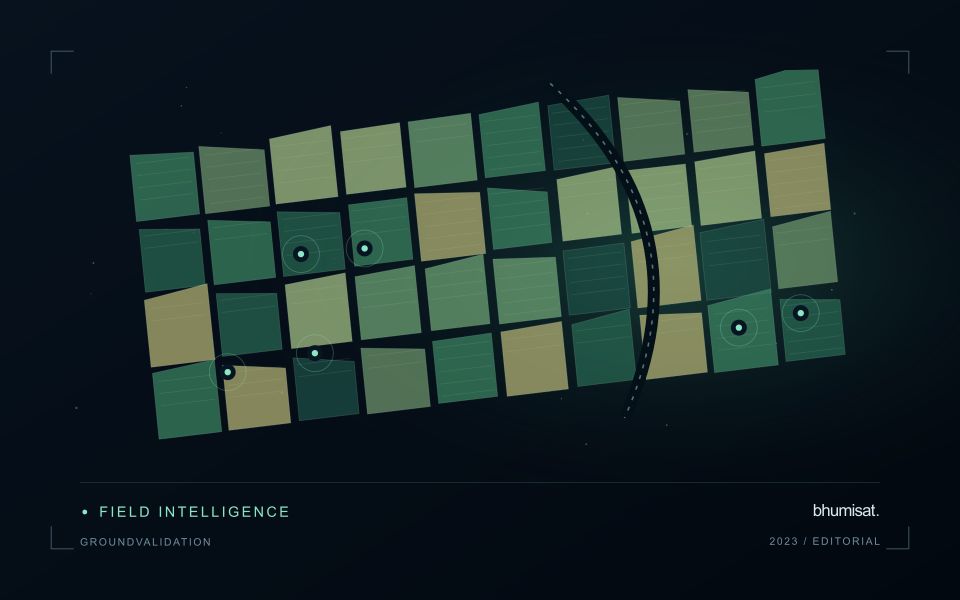
This working guide considers designing ground validation for satellite products in potato growing fields. The immediate decision is to focus scouting within potato fields. Useful reference evidence includes emergence records, canopy stage and representative plot observations. The case is an illustrative planning context, with assumptions to check against the actual sensor, landscape and project requirements.
The setting: Potato growing fields
Potato monitoring begins with the distinction between the canopy visible from above and the crop component ultimately harvested below ground. Establishment timing, variety, row structure and management can create different canopy patterns across fields. An image service should specify whether it is supporting crop-stage assessment, identifying areas for inspection or estimating a defined production variable. These objectives require different reference measurements and should not be combined into one unqualified vegetation score.
Maintain a field timeline that includes planting, emergence and the operations that can affect canopy appearance. Early observations may contain a large soil contribution, while later observations may show a more continuous canopy. Cloud and shadow contamination, field edges and neighbouring land cover can alter summaries at either stage. Compare observations using suitable quality rules and retain the acquisition dates so that a recent-looking map does not conceal an old measurement.
A field team should collect consistent crop-stage and canopy observations across both flagged and typical areas. Record management context and sampling support rather than relying on an isolated photograph. A vegetation change cannot establish the presence of a specific disease, and a canopy index is not a direct measurement of tuber yield. Evaluate any production model with appropriate harvest data and independent assessment, while keeping the simpler inspection-priority product transparent about what it actually observes.
Start with the intended claim
Validation tests how well a product represents a defined quantity under specified conditions. It differs from calibration, which adjusts an instrument or model using reference information. Begin with the claim the product needs to support: class membership, surface reflectance, canopy height, water quality, or an area estimate. State the required spatial scale, time interval, and acceptable error. These choices determine the reference method and sample design. Collecting convenient field points first and deciding later what they prove usually leaves important conditions untested.
Reference measurements also contain uncertainty. Positioning error can place a sample in the wrong satellite pixel, a point instrument may not represent a heterogeneous footprint, and measurements made on different dates can describe real surface change. Record instrument calibration, sampling protocols, timestamps, coordinates, observation conditions, and uncertainty where available. For interpreted labels, retain the evidence used, class rules, and ambiguous cases. Agreement among interpreters is useful to examine, but agreement alone does not guarantee that the shared interpretation is correct.
Keep the assessment independent
Separate validation data from observations used to fit thresholds, train models, select features, or tune processing. If assessment sites repeatedly influence revisions, they have become development data and a fresh independent assessment is needed. Spatially clustered samples can make performance look stronger when neighboring training and test locations share conditions. Use a design that reflects the target population and report its limitations, including inaccessible areas or environmental conditions missing from the sample.
Choose metrics that match the product. For categorical maps, examine a confusion matrix and errors for individual classes, not just overall agreement. For continuous measurements, report bias and a suitable error measure alongside sample count and the range of reference values. Plot residuals against relevant conditions to expose failures hidden by an average. For area estimates, carry the probability sampling design through estimation and uncertainty calculations. Preserve rejected matchups and their reasons so that quality screening remains auditable. A useful validation report explains where the product works, where evidence is sparse, and which errors matter for the intended decision. Publishing reference protocols and assessment code makes later comparisons more credible and helps others reproduce the evaluation.
Define a representative reference sample
A reference sample should represent the situations in which a method will be used. Begin by defining the target population: locations, time periods, management conditions, surface types, or instrument states that belong within the intended application. A collection of convenient observations may be valuable for exploration, but it does not automatically support conclusions about that wider population. Make the scope of the sample visible before calculating a summary of performance.
Consider a stratified design when important conditions are unevenly represented. Relevant strata might include different landscape types, developmental stages, observation quality levels, or ranges of the variable being estimated. Choose sample locations within those groups using a documented rule, and retain the information needed to understand their selection. Where access restrictions affect the sample, record the excluded conditions so that the limits of the resulting evaluation remain clear.
Keep development and evaluation evidence separate where the purpose of the study requires an independent test. Nearby observations or repeated measurements can share information, so a random split of individual records may overstate independence. A split organised by location, period, or operational unit can provide a more demanding comparison. The appropriate design follows the intended deployment, the structure of the observations, and the errors that matter to the user.
Match the timing of reference observations
The value of a reference measurement depends partly on how well its timing matches the observation being evaluated. A surface, crop, water body, or instrument state may change between the two measurements. Start by documenting the acquisition time of every source and the period over which the reference observation applies. Avoid treating a date entered during data upload as though it were necessarily the time when the measurement was collected.
Define an acceptable timing relationship for the application. A slowly changing structural feature may tolerate a broader comparison window than a rapidly changing surface condition. The window should be justified by the process being studied and by any available contextual records. If conditions change within that period, consider separating the observations into suitable groups rather than combining them under a single assumption of comparability.
Preserve information about interventions and events between observations. A management operation, rainfall episode, disturbance, or change in sensor configuration can alter the interpretation of a comparison. Record the event and decide whether the pair remains suitable for evaluation. Where the timing mismatch cannot be resolved, describe the comparison as qualified evidence. This is more informative than allowing an uncertain match to influence a performance statistic without explanation.
Bring the evidence back to the decision
Useful uncertainty communication identifies the limitation, explains how it could affect the result, and connects it to a practical response. Some decisions can proceed with a qualified estimate; others require another observation or an independent check. Preserve uncertainty information through processing and delivery so that it is available at the point of use. This makes the analysis more accountable and gives the team a clearer basis for deciding which additional evidence would most improve the outcome.
Sources & further reading
Explore the bhumisat spacecraft concept and our vision towards 2030, or return to the journal.